|
|


|


|
|
|
|
|
|
Child Lake Salt Meadows (Salt Flats)
Natural Area
The Child Lake Meadows are 388.5 hectares in size and are located south of the Boyer River. This Natural Area is midway between the communities of Fort Vermilion and High Level in the Eleske/Rocky Lane area. Access is by the Machesis Lake Road or from the old Eleske Highway (Rocky Lane Road).

The meadows include a diversity of habitats, from aspen forest to dry meadows to wetlands and contain several species uncommon to northern Alberta. In fact, these meadows are the only northern salt meadows identified with dry meadow vegetation types. Salt meadows are uncommon in the Boreal Forest Natural Region.
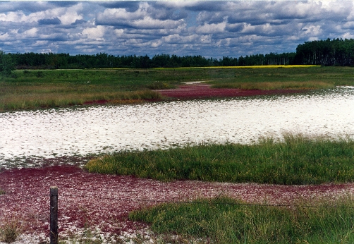
Salt patches on the surface of the soil, give an appearance of snow or white sand.
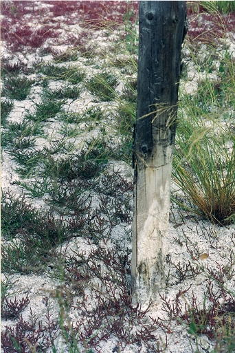
The soil is extremely alkaline making it home to plants that are seldom seen in the north.
The Eleske Heritage Trail brochure is a handy guide. Pick one up at the Visitor Centre in High Level or in Fort Vermilion.
Photos by Marilee Cranna Toews, Fort Vermilion
Acknowledgements: Summer Career Placement Program staff, Keith Klassen (2004/2005) & Jordan Lambert (2006) and