|
|


|


|
|
|
|
|
|
Ponton River Valley - A Natural Area or Not?
The Ponton River Natural Area (?), recorded as 1,569.74 hectares in size, is located east of High Level and northwest of Fort Vermilion. The source of the Ponton River is Margaret Lake in the Caribou Mountains.
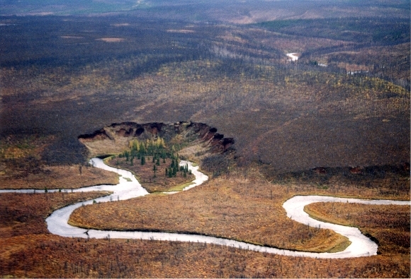
The river meanders tightly through very remote country before uniting with the Boyer (formerly Paddle) River and joining the Peace, a few miles downstream from the Fort. Numerous oxbow lakes and slumping peat lands characterize the Ponton.
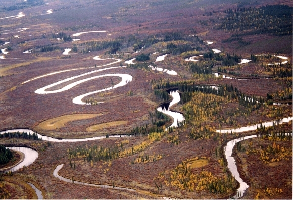
Though apparently not designated as such, this Natural Area encompasses part of the Ponton River Valley. It provides excellent wildlife habitat with various ungulates using it as a travel corridor and calving range. The river supports several fish species, with some of the best northern grayling fishing. It is frequented by outdoor recreational groups for the purpose of hunting, fishing, canoeing and hiking.
The remains of petrified forests have been found along parts of the Ponton and Peace Rivers. Petrified wood is Alberta's provincial stone.
Given the added importance of this valley in linking the Caribou Mountains Wildland Park to the nationally significant Peace River, we would do well to insure its future and ongoing protection.
Photos by Marilee Cranna Toews, Fort Vermilion