|
|


|


|
|
|
|

|
|
Vermilion Rapids and Chutes
on the Peace River
From its headwaters in the Rocky Mountains, the Peace River meanders (700 miles 1167 kilometres) northeast joining the Slave and Mackenzie River systems on route to the Arctic Ocean. Only the Vermilion Rapids and Chutes interrupt navigation on the Peace. The Peace is recognized "unofficially" as a Canadian Heritage River.
The Rapids (Meatina Powistik "The Real Rapids")
 Fort Vermilion
Heritage Centre 998.67.1
Aubrey Milner Collection
Fort Vermilion
Heritage Centre 998.67.1
Aubrey Milner Collection
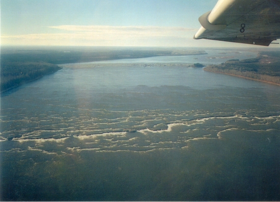
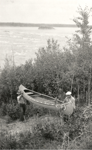
The Rapids are 78 kilometres (49 miles) downstream from Fort Vermilion. Keep a sharp lookout to the south for the Wabasca (Loon) River. It is somewhat hidden by a wooded island. From here, it is about 20 kilometres (13 miles) downstream to "The Rapids". They're not visible from afar, but canoeists should hear their distant roar. They have been described as "herds of great sheep jumping over one another." They are about a mile wide and the roughest part is only ½ mile in length.
 Fort Vermilion Heritage Centre 998.68.1 Marcel LaCoure Collection
The Portage
Running parallel to the south bank is a trail used by many people through the years. You can disembark at the Upper Landing where an old storage shed reveals names of river travellers from days gone-by. The trail, about 8 kilometres (5 miles) long, takes you "up hill and down dale" weaving a path through the poplars and taking a final long slope to the river's edge.
Fort Vermilion Heritage Center 990.4.36.61
Glenbow Museum NA 2546-19
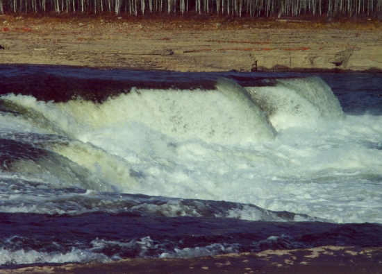
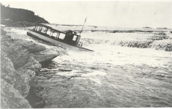
The Chutes (Nepegabeketik "Where the Water Falls")
"The Chutes" look like a series of "fan-shaped, stone steps" made of limestone rock and shale. They are approximately 4 kilometres (2.4 miles) below "The Rapids". Depending on the season and whether the river is running high or low, "The Chutes" range from 15 to 25 feet in height. In low water they are dangerous and could cause a shake up if you try to go over them. In high water, with proper experience, they are navigable.
 Fort Vermilion Heritage Centre 990.4.74.55 Provincial Archives of Alberta
A 2647
Fort Vermilion Heritage Centre 990.4.74.55 Provincial Archives of Alberta
A 2647
The boat which supplied power for police scow, Carrying Premier Brownlee and his party (1929)
Little Red River Post
The old Hudson Bay post of Red River is approximately 6 kilometres (3.75 miles) downstream on the south side. After "The Chutes" the nearest settlement is Fox Lake, about 21 kilometres (12.6 miles) downstream on your right.